A Name That Confuses, A Place That Mattered
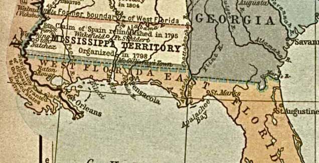
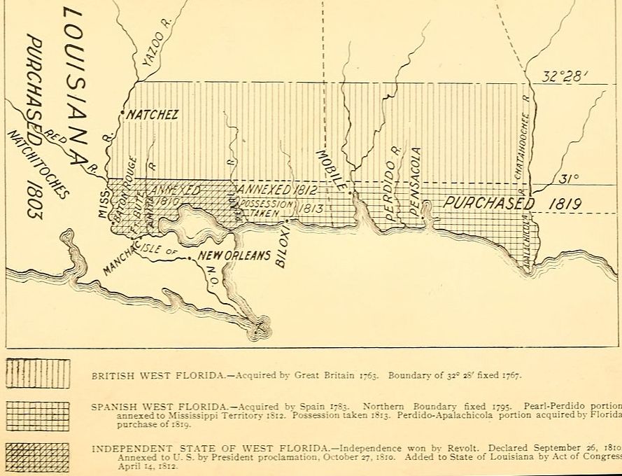
Ask most Americans today where "West Florida" is, and they will point somewhere south of Pensacola or perhaps toward the Gulf coastline of today’s Sunshine State. They would be wrong, at least when it comes to the turbulent years between 1810 and 1822. The region known as West Florida during this period was not the peninsula we know as Florida at all. It was a long, narrow coastal strip running east from the Mississippi River along the Gulf of Mexico toward the Perdido River, covering territory that today constitutes parts of Louisiana, the Gulf Coast counties of Mississippi and Alabama, and what is now the western Florida Panhandle. It was "West" Florida only in contrast to "East" Florida, the peninsula to its east, and both names descended from decisions made by the British Empire in 1763. These decisions would have consequences on American foreign policy for more than a half-century.
This is the story of that strip of contested land: how empires traded it, how settlers revolted over it, and a tiny republic that flickered into existence for just seventy-four days. And how the United States, just thirty-four years removed from the events of 1776, through a combination of legal argumentation, quiet intrigue, and outright military pressure, absorbed it piece by piece. It was a remarkable turn of events that took place between April 1810 and the formal organization of the Florida Territory on March 30, 1822.
How "West Florida" Got Its Name: The British Reorganization of 1763
To understand why a place that seems geographically unrelated to the modern state of Florida was called "West Florida," one must go back to the Seven Years' War, known in America as the French and Indian War, and the diplomacy that ended it.
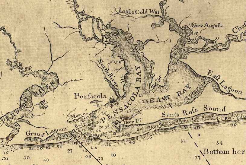
By the Treaty of Paris of February 10, 1763, Great Britain acquired an enormous swath of North American territory from both France and Spain.[1] From Spain it received the colony of Florida; from France it received the eastern half of Louisiana (the portion east of the Mississippi River, excluding New Orleans). Faced with organizing this new Gulf Coast territory, the British found it geographically awkward to govern as a single unit. They divided it into two separate provinces. East Florida corresponded roughly to the modern Florida peninsula with St. Augustine as its capital, and West Florida encompassed the Gulf Coast strip from the Apalachicola River westward to the Mississippi River, with its capital at Pensacola.[2]
In 1767, seeking to encourage settlement and include the established communities at Natchez and Baton Rouge, the British extended West Florida's northern boundary northward from the 31st parallel to the 32nd degree and 28 minutes, essentially to the mouth of the Yazoo River.[3] This expansion meant that West Florida now included a substantial interior as well as its Gulf shoreline. The province was, in short, a long coastal corridor of enormous strategic value. Whoever held it controlled the eastern bank of the lower Mississippi River, the outlets of rivers draining much of the interior South, and the approaches to the Gulf of Mexico.
When the American Revolution ended with the Treaty of Paris of 1783, Britain returned both Floridas to Spain. Spain had entered the war in 1779 as an ally of France and had wrested West Florida from British hands through Bernardo de Gálvez's campaigns. The new United States claimed the territory north of the 31st parallel. Spain, however, argued that its boundary should reach northward to the old British line at 32°28', a dispute it would not concede until Pinckney's Treaty of 1795, also called the Treaty of San Lorenzo.[4] That agreement fixed the northern boundary of Spanish West Florida at the 31st parallel and granted Americans free navigation of the Mississippi River. These were two concessions that should have settled matters. They did not.
The Louisiana Purchase and the Boundary Dispute That Would Not Die
In October 1800, Napoleon Bonaparte pressured Spain into signing the Treaty of San Ildefonso, by which Spain ceded Louisiana back to France. As a critical point, this retrocession did not include West Florida, which remained under Spanish authority as a separate province.[5] Three years later, in April and May 1803, France sold Louisiana to the United States in the Louisiana Purchase. The treaty language was famously vague. Louisiana was to be transferred with:
the same extent that it now has in the hands of Spain, and that it had when France possessed it.[6]
This ambiguity immediately became a weapon in American hands. President Thomas Jefferson, his ministers Robert Livingston and James Monroe in Paris, and subsequently President James Madison all argued that West Florida, or at least a portion of it had originally been part of French Louisiana before 1762. Therefore, it should have passed to the United States in 1803.[7] The argument was legally indefensible but politically convenient. France itself had explicitly excluded West Florida from the deal. As the Miller Center notes, "in 1804 France insisted West Florida had not been part of the purchase."[8] Spain refused to negotiate, and the controversy festered for years.
The strategic stakes were enormous. As previously mentioned, whoever possessed this Gulf Coast land held tremendous advantage. As historian Kendrick C. Babcock summarized, the "persistent desire of the United States to possess the Floridas, between 1801 and 1819, amounted almost to a disease, corrupting the moral sense of each succeeding administration."[9]
The People of West Florida: A Combustible Mix
By 1810, the population of Spanish West Florida was an interesting hodgepodge. The land was claimed by the United States, governed by the Spanish, and inhabited largely by the French and English with a sprinkling of other European settlers. After Pinckney's Treaty in 1795, American settlers streamed southward into the region, drawn by cheap land and its strategic commercial position. By 1810 many districts, especially the wealthy Feliciana District near the Mississippi Territory border, had a heavily American character.
When the Louisiana Purchase of 1803 failed to bring West Florida into American hands, the pro-American population was deeply disappointed. Planters who had moved south from Georgia, the Carolinas, and Virginia raised cotton and indigo and increasingly chafed under Spanish governance. They regarded Spanish authority as inefficient and capricious, and they believed, with considerable encouragement from Washington, that their land was rightfully American territory.
The Spanish governor of the district, Carlos de Hault de Lassus, was a Frenchman serving under Spanish authority. This was an additional layer of confusion that reflected the region's history. He struggled to maintain order among a population that was at best indifferent to his authority. By 1810, plans to test his authority began to form. Not only by the planters of Feliciana. Washington, too, was developing its own plans for the province.
Madison's Position in Early 1810: Claims, Agents, and a Watching Brief
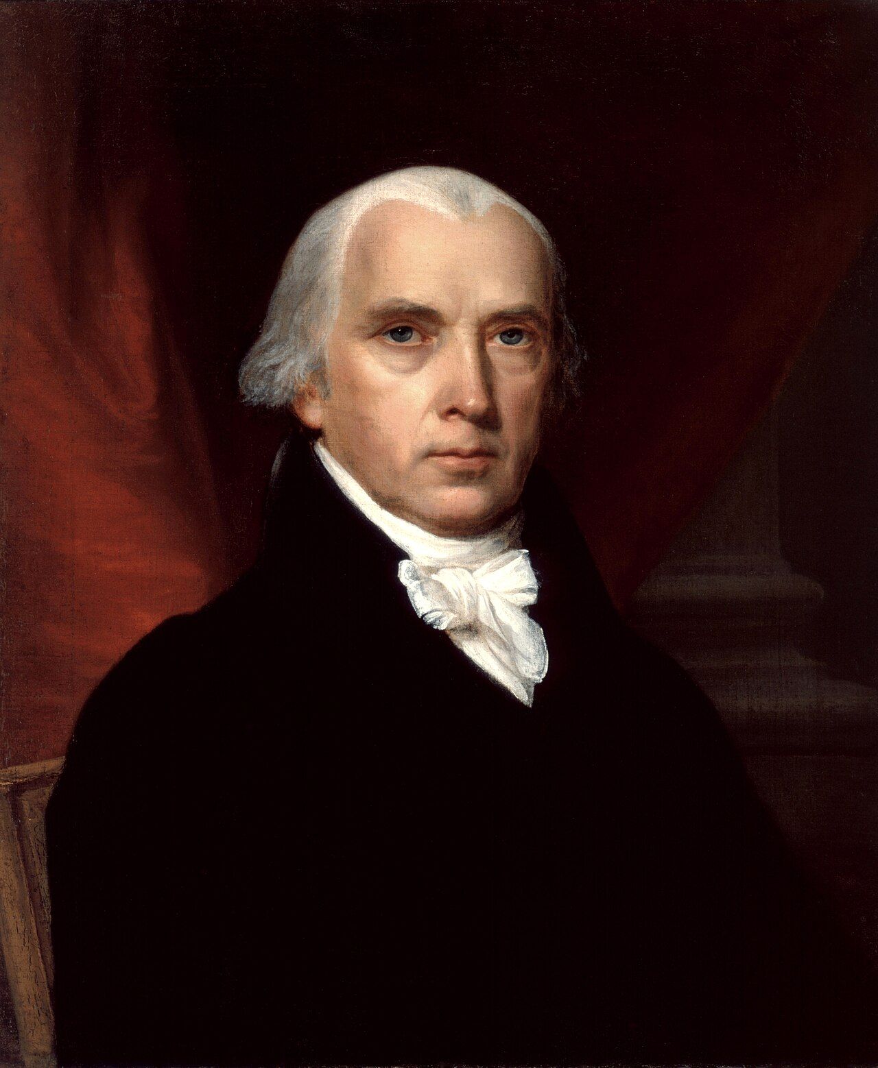
President Madison's claim to West Florida was not new in 1810. The argument had been pressed since the Louisiana Purchase itself in 1803, and by 1804 it had already met its first significant setback. France formally told Jefferson's administration that West Florida had never been part of the deal.[10] Madison, as Jefferson's secretary of state at the time and now as his successor in the presidency, had inherited and continued to press the claim regardless. The American position, as later distilled in Madison's own words, was that the events of 1810 represented "a crisis... subversive of the order of things under the Spanish authorities," and that the territory in question rightfully belonged to the United States as a portion of the Louisiana cession.[11]
In the year 1810, Spain's empire itself was fracturing. Napoleon's seizure and imprisonment of the Bourbon monarch Ferdinand VII in 1808, and his installation of Joseph Bonaparte on the Spanish throne, had triggered popular insurrection across Spain. This moved the legitimacy of royal authority in every Spanish colony into doubt.[12] From California to South America’s Cape Horn, Spanish America was under stress and Madison was watching carefully. He recognized, as his successors would for the following decade, that Spanish weakness in Europe created opportunities on the American continent that strength never had.
Samuel Fulton
The documentary record shows the administration had eyes inside West Florida well before the events of autumn 1810. One of the more interesting figures in Madison's correspondence is Samuel Fulton, an American-born military adventurer with a tangled history in French and Spanish service. Fulton had been involved in earlier intrigues against Spanish Florida and Louisiana in the 1790s. He had corresponded with Madison since 1802 seeking a position in the U.S. government, and had since settled at Baton Rouge where he had married the Spanish governor's daughter. He had now risen to command the Spanish militia of West Florida as adjutant general and commandant of cavalry.[13] On April 20, 1810, Fulton wrote directly to Madison, reporting on conditions in the province and reminding the president of his long-standing wish to be "useful to my own Country."[14] Fulton's house in Baton Rouge would later become one of the meeting places for the revolutionaries. This positioned a Spanish militia officer with the American president's ear inside the conspiracy that was about to unfold.[15]
This pivotal moment, where Fulton’s willingness to commit treason against Spain was displayed in April 1810, came 144 months before Florida became an American Territory in March 1822.
Governor David Holmes
Madison's principal instrument for gathering intelligence on the ground was Governor David Holmes of Mississippi Territory, whose territory bordered West Florida directly and whose officials and informants moved freely across the loosely guarded frontier. Even before the convention movement became public, Holmes was reporting to the State Department on the collapse of effective Spanish authority in the province. In a June 1810 dispatch, he described a population without confidence in its government, fractured into American, British, Spanish, and French factions, with the Spanish administration reduced to relying on an improvised neighborhood police whose operations Holmes judged both "inefficient" and "unjust."[16]
William Wykoff Jr.
Madison's administration also deployed a quieter instrument of persuasion during these months. William Wykoff Jr. was an agent sent into West Florida, by the account of at least one modern historian, with the implicit blessing of Governor Claiborne of Orleans Territory, to encourage the American settlers to request annexation by the United States.[17] Wykoff's mission has left a thin documentary trail and Madison's papers note candidly that "even less... is known about Wykoff's mission to Baton Rouge" compared to the parallel and better-documented mission of George Mathews in East Florida the following year.[18] What is clear is that Wykoff was on the ground in these early months, encouraging the very planters who would soon organize the convention movement. He was telling residents, in terms later recorded, that should they achieve "a political separation from the parent country, their incorporation into our Union would coincide with the sentiments and policy of the United States."[19]
What is not yet visible this early in the year is any order for actual U.S. troop movements into West Florida. Madison issued direct instruction to keep Mississippi's militia in a state of readiness, telling Secretary of State Robert Smith that Holmes should be "attentive to the means of having his Militia in a state for any service that may be called for" in the event of "foreign interference" or "internal convulsions" in West Florida. This was recorded in a letter dated July 17, 1810, written from Madison's home at Montpelier.[20] The military posture, in other words, hardened over the summer. Before the summer, the early months of 1810 show the quieter machinery of the policy. The president was already convinced of his legal claim, agents were positioned inside the territory, and a network of informants were relaying information. This was all before the first shot was fired at Fort San Carlos in September. It was against this backdrop that the planters of West Florida began to organize.
The Conspiracy Takes Shape: June–September 1810
The revolt of September 23, 1810 did not emerge from nowhere. It was the product of months of carefully concealed organization, rooted in frustration from a small circle of wealthy planters who understood that success required both secrecy and the right moment.
Some of that frustration had deep roots. Many of the citizens of West Florida in 1803 were American-born settlers who found themselves disappointed under Spanish rule. They even attempted an unsuccessful revolution in 1804, put down by the Spanish military.[21]That earlier failure left wounds and lessons. Among the most persistent agitators in the intervening years were the Kemper brothers. Nathan, Reuben, and Samuel Kemper, who were known as an uncouth, boozing, and violent trio once described by a Spanish official in the area as "white Indians and river pirates." From 1804 to 1810, the Kempers engaged in episodic attempts to expel the Spanish from West Florida and actively sought to engage other Americans in their cause.[22]
By 1810, however, it was not the Kempers but the planter class of the Feliciana District who drove events. Spain's weakening grip following Napoleon's invasion had changed the calculation. The popular governor of West Florida, Don Carlos de Grand-Pré, had recently been replaced by the bland and vacillating Carlos de Hault de Lassus, and settlers feared that French control of Spain meant French control of the Gulf Coast as well.[23]Wykoff worked in the background to give this anxiety a direction toward annexation by the United States. Whether his prodding helped is unknown as the planters were already moving.
The conspirators were acutely conscious of the need for secrecy. The revolutionaries were made up of British, Irish, Scottish, and American and realized that only one bond could keep these several nationals together. Strangely, that was their membership in Freemasonry. In consequence, all their meetings were held "on the square" and on the "five points of fellowship," in spite of the fact that in the Feliciana district, as elsewhere in Spanish West Florida, such fraternal gatherings were strictly taboo.[24] Masonic lodge meetings provided the cover under which rebellion was planned.
The key organizing figure in these early months was John Hunter Johnson, owner of the plantation where most of the preliminary secret meetings were held. Johnson was not only the brains and moving spirit of the rebellion, but with his three brothers, Isaac, Charles, and Joseph, he became the strong right arm of the Feliciana planters against Spanish rule. It was he who dictated the wording of the various proclamations issued and the demands made by the members of the convention when it held the first open meeting.[25]
The public phase began on June 23, 1810. A large group of Feliciana residents gathered at Egypt Plantation, the estate of Lewis Stirling. There they called for the establishment of a convention, ostensibly to "secure themselves against foreign invasion and domestic disturbance." Four men were selected as delegates: John Rhea, John Johnson, William Barrow, and John Mills. They were described in a contemporary newspaper account as "all men of respectability and influence in this country." They were authorized to solicit representatives from the neighboring districts of Baton Rouge, St. Helena, and Chifoncte, and to convene a full convention at St. Johns Plains on July 25, 1810.[26]
Governor David Holmes of Mississippi Territory reported on the July 25 convention to Secretary of State Robert Smith on August 3, 1810, one of several dispatches that kept Madison fully informed of the brewing rebellion. Holmes described the delegates as "all of them wealthy and respectable Men" sent to communicate with settlers throughout West Florida in order to persuade them to adopt a similar course of action.[27]
When the convention met at St. Johns Plains on July 25, John Rhea of Feliciana was selected as chairman. Fearful of provoking the wrath of Spain, the assembled delegates avoided open discussion of rebellion and instead drafted a resolution declaring their intention to assist de Lassus in governing the territory, due to his weakened capacity as a result of events in Europe. Although the resolution was clearly a veiled usurpation of authority, with only twenty-eight troops at his disposal, de Lassus feigned acceptance.[28]
This was the genius of the strategy. The convention wrapped the systematic stripping of authority from the Spanish governor in the language of loyal assistance. De Lassus, hopelessly outnumbered and politically isolated, had little choice but to play along…for a while. Behind that façade, the planters quietly armed themselves, organized a militia, and prepared for action.[29]
It was only in mid-September that de Lassus' mask slipped. The governor had written a letter on September 12 revealing that he had been feigning cooperation while quietly preparing a military response. That letter was intercepted by the convention leaders, and it became the final trigger.[30]Within days, the convention stopped pretending and moved to open revolt.[31]
One more detail deserves recording. The Bonnie Blue Flag that flew over the captured fort was not the work of an unknown hand. It was sewn by Melissa Johnson, the wife of Major Isaac Johnson of the West Florida Dragoons, further demonstrating the coordination involved.[32]
The Seventy-Four-Day Republic: September–December 1810
On September 23, 1810, Colonel Philemon Thomas, a Kentucky-born veteran of the American Revolutionary War who had settled in the Feliciana District, led an armed force against Fort San Carlos, the main Spanish garrison at Baton Rouge.[33] In a brief fight that killed two Spanish soldiers and wounded five, the rebels captured the fort, imprisoned Governor de Lassus, and raised their Bonnie Blue Flag over the ramparts, all without loss to themselves.
Three days later, on September 26, John Rhea, president of the West Florida convention, signed a Declaration of Independence, and the Republic of West Florida came formally into being.[34]The declaration echoed the language of 1776, stating:
"It is known to the world with how much fidelity the good people of this Territory have professed and maintained allegiance to their legitimate sovereign, while any hope remained of receiving from him protection for their property and lives."[35]
The new republic's constitution was modeled directly on the United States Constitution, dividing the government into executive, judicial, and legislative branches, with a bicameral legislature of Senate and House of Representatives and a governor chosen by the legislature rather than direct popular vote. The official name adopted in the constitution was, pointedly, the "State of Florida" — not a republic, but a state, signaling the founders' expectation that annexation by the United States would follow quickly. The republic applied immediately to Washington for statehood, an appeal that placed Madison in the awkward position of acknowledging a government he intended to dissolve.
The capital was established at St. Francisville, a small but prosperous town in the Feliciana District. In the weeks that followed, the convention set about constructing the machinery of a functioning government. On November 7, the citizens elected their bicameral legislature, and on November 29, Fulwar Skipwith was inaugurated as governor. This was the first and only head of state the Republic of West Florida would ever have.
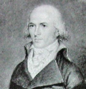
Fulwar Skipwith was one of the most fascinating figures in this drama. Born on February 21, 1765, in Dinwiddie County, Virginia, Skipwith was an American soldier, diplomat, politician, and farmer. A veteran of the American Revolutionary War, he served as U.S. Consul in Martinique, and later as the U.S. Consul-General in France. He was instrumental in negotiating the Louisiana Purchase in 1803, which is an extraordinary irony, since the very ambiguity of that Purchase was now being used to justify annexing his own republic. His cousin Henry Skipwith was a brother-in-law to Thomas Jefferson, giving Skipwith personal connections at the highest levels of the American government.[36] Despite those connections, he would find no sympathy in Washington for the cause of West Florida independence.
The fledgling republic even produced its own patriotic verse. One marching song included the lines:
"West Florida, that lovely nation, / Free from king and tyranny, / Thru' the world shall be respected, / For her true love of Liberty."[37]
The Bonnie Blue Flag: America's First Lone Star
The flag raised over Fort San Carlos on the morning of September 23 deserves its own telling, for it would outlive the republic that flew it by half a century. The design was strikingly simple: a lone five-pointed white star centered on a field of deep blue. It was the first "Lone Star" flag in American history, predating by decades both the Republic of Texas flag and the Confederate battle standards that would adopt similar imagery.
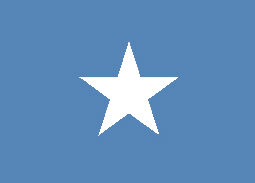
Governor Skipwith proclaimed himself ready to "die in defense of the Lone Star flag,” a vow his actual conduct would not bear out, as demonstrated in the next section. The flag itself proved more durable than his resolve. When Southern states began seceding in 1861, the Bonnie Blue Flag was revived as a symbol of rebellion and defiance, celebrated in a famous Confederate song of the same name. The Republic of Texas, declared in 1836, also adopted a nearly identical lone-star design, cementing the imagery the West Florida rebels had first raised over Baton Rouge.
Madison's Proclamation: A Republic Swallowed
The Republic of West Florida's fate was sealed from the moment it declared independence. President James Madison had been monitoring the situation closely from Washington D.C., through his agents in the region. The emergence of an independent republic on the Gulf Coast alarmed rather than pleased him. A "self-created independent Government" claiming the authority to form treaties, establish commerce, and provide for the common defense was precisely what Madison did not want. It raised serious questions about sovereignty that, if left unresolved, would ultimately undermine the American claim to West Florida altogether.
Immediately after a cabinet meeting on October 25, Madison moved swiftly: a proclamation was drafted for the annexation of West Florida, justifying the policy on the grounds that the territory had always been part of the Louisiana colony and should have been transferred to the United States in 1803.
On October 27, 1810, Madison issued his proclamation. In language that has become a landmark primary source for this period, the President declared:
"Now be it known that I, James Madison, President of the United States of America, in pursuance of these weighty and urgent considerations, have deemed it right and requisite that possession should be taken of the said territory in the name and behalf of the United States."[38]
He directed Governor Claiborne to take possession and assured the inhabitants they would be "protected in the enjoyment of their liberty, property, and religion."[39]
Notably, Madison did not inform Congress of the proclamation until his annual message in December. The move was constitutionally aggressive, and Federalist opponents proclaimed it unconstitutional, but Congress ultimately voted along party lines to approve it.[40]
Governor Fulwar Skipwith, speaking for the fledgling government of West Florida, formally protested the U.S. takeover. Armed resistance was briefly discussed, but without outside support it was certain to fail. The republic had no army capable of resisting U.S. forces, no foreign patron willing to recognize it, and no realistic prospect of survival. Skipwith's earlier vow notwithstanding, he ultimately stood down. When American military forces entered the capital of St. Francisville on December 6 and Baton Rouge four days later, they met no resistance.
On December 7, 1810, Governor Claiborne issued an ordinance designating the land comprising the Republic of West Florida as the county of Feliciana. By the afternoon of December 10, the last defenders of the Republic had marched out of Fort San Carlos and laid down their arms.
The republic had lasted exactly seventy-four days. It has been called, variously, "a lusty Tom Thumb Republic," "the stout little republic," and less charitably,
"simply a mock government used by the Americans to cloak their aggression."[41]
The Geography of the Controversy: How Big Was West Florida?
West Florida's boundaries shifted significantly after the British era, and the most consequential of those shifts shaped the dispute that would consume American diplomacy for the next quarter century. When Spain regained the Floridas in 1783, it won them back from Britain by Governor Bernardo de Gálvez's campaigns, which had captured Baton Rouge and Natchez in 1779, Mobile in 1780, and Pensacola in 1781. This boundary dispute with the United States simmered for over a decade until Pinckney's Treaty fixed the northern line at the 31st parallel in 1795. In its final Spanish configuration, West Florida ran from the Perdido River in the east to the Mississippi in the west, bounded on the north by the 31st parallel and on the south by the Gulf. This was a considerably smaller province than the one the British had governed, but still a substantial one.
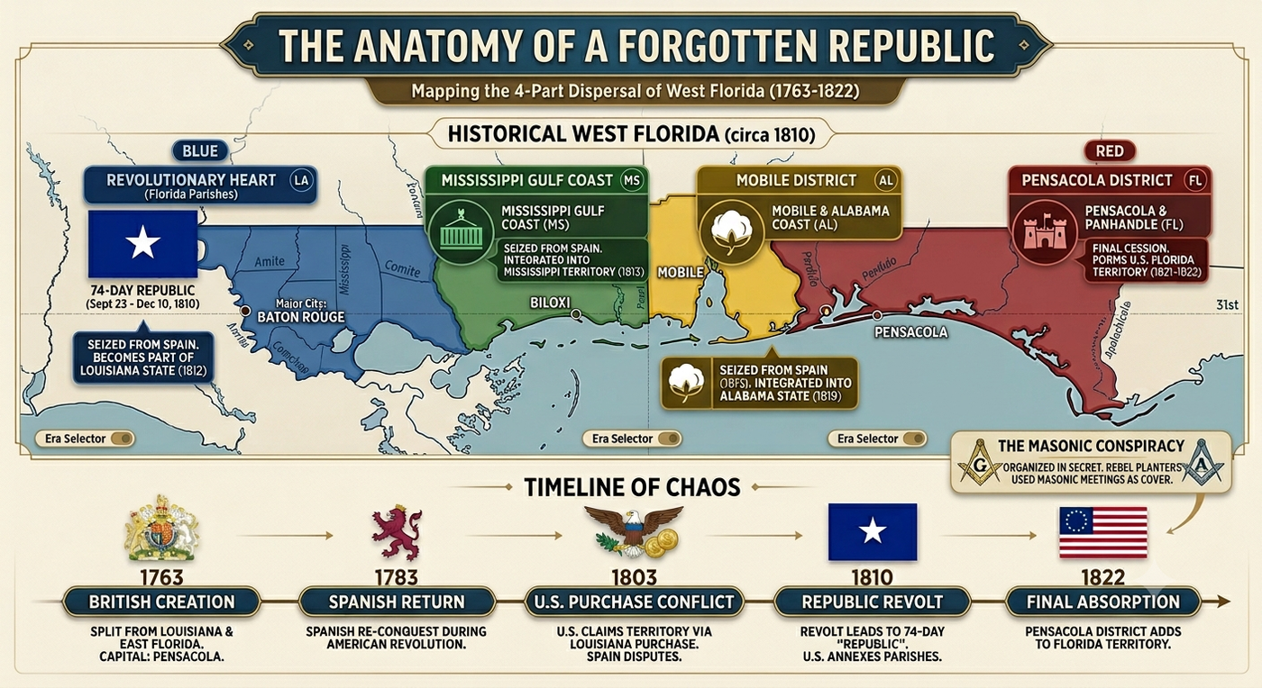
Independent West Florida, won by the revolt of September 23, 1810, encompassed all of that remaining territory, from the Mississippi to the Perdido River, roughly 200 miles east-to-west and perhaps 50 to 100 miles north-to-south. It was, in other words, not a peninsula at all, but a Gulf Coast shelf, and not one acre of it lay within the borders of the modern state of Florida. Where, then, did all of that land actually go? The answer unfolded over the next twelve years, in four distinct stages.
The Four-Part Dispersal: Where Old West Florida Ended Up
The American absorption of West Florida did not happen all at once, nor did the territory end up in a single state. The old Gulf Coast province was carved into four distinct pieces, each of which followed its own path into the American union — which is why "West Florida" vanished from the map even as its pieces lived on in four separate states.
Part One: The Florida Parishes of Louisiana (1810–1812)
The first and most dramatic piece was the westernmost strip, the land from the Mississippi River east to the Pearl River, which was the heart of the 1810 rebellion and the Republic of West Florida. After Madison's proclamation of October 27, 1810, this strip was placed under the administration of Orleans Territory, governed by William C.C. Claiborne. It was formally organized as Feliciana County in December 1810.
When Orleans Territory, which had been organized in 1804 from the southern portion of the Louisiana Purchase, had accumulated sufficient population, Congress admitted it to the Union as the state of Louisiana on April 30, 1812. This was exactly nine years to the day after the Louisiana Purchase treaty was signed. The former West Florida strip came in with it, forming what became known as the Florida Parishes: East Feliciana, West Feliciana, East Baton Rouge, St. Helena, Livingston, Tangipahoa, Washington, and St. Tammany. These eight parishes retain the name "Florida Parishes" to this day, a permanent reminder that they were once part of a different colony entirely. Baton Rouge, the city where rebels stormed Fort San Carlos and raised the Bonnie Blue Flag, became the eventual state capital of Louisiana in 1849.
Part Two: The Gulf Coast of Mississippi (1813–1817)
The next strip eastward, from the Pearl River to roughly the Pascagoula River along the Gulf Coast, had also been part of Spanish West Florida before American forces moved into the region in 1813. This coastal fringe, including what are now Hancock, Harrison, and Jackson counties along Mississippi's Gulf Coast, was attached to Mississippi Territory after the Spanish withdrew.
Mississippi Territory itself had been one of the earliest organized territories in the American South, established by Congress on April 7, 1798. The broader American military advance along the Gulf in 1813 culminated in Wilkinson's seizure of Mobile. Mississippi Territory's boundaries were extended southward to encompass this strip as well. When Congress split Mississippi Territory in 1817, the western portion, including this coastal strip of old West Florida, became the state of Mississippi on December 10, 1817. Mississippi thus entered the Union with a short but strategically valuable Gulf coastline that had, just seven years earlier, been a Spanish province. The towns of Biloxi, Gulfport, and Pass Christian all sit on what was once West Florida soil.
Part Three: Mobile and the Alabama Coast (1813–1819)
The most valuable single piece of the middle section was Mobile itself. It was the finest natural harbor on the northern Gulf Coast and the commercial outlet for the entire interior river system draining what would become Alabama. Mobile had been the capital of French Louisiana in the early eighteenth century, then a British town, then a Spanish one. General Wilkinson's forces captured it from Spain on April 15, 1813, when the small Spanish garrison at Fort Charlotte surrendered without a fight, vastly outnumbered.[42]
The Mobile district, stretching from the Perdido River in the east to the Pearl River tributaries in the west, and including the rich delta country around Mobile Bay, was attached to Mississippi Territory in 1813. When Congress divided Mississippi Territory in 1817, the eastern half became Alabama Territory, organized on March 3, 1817. Two years later, having grown rapidly with cotton planters pouring in from the Carolinas and Georgia, Alabama was admitted to the Union as the state of Alabama on December 14, 1819. Mobile came with it, along with the entire coastal strip of old West Florida between the Pearl River and the Perdido River. Mobile would grow into one of the most important ports in the antebellum South.
Part Four: The Pensacola District and Florida Territory (1821–1822)
The easternmost piece of old West Florida, the Pensacola district and the lands between the Perdido River and the Apalachicola, was the last to fall into American hands, and it required the most dramatic means. Unlike the western strips, which were seized under the pretext of the Louisiana Purchase claim, the Pensacola district was unambiguously Spanish territory to which the United States had no credible legal claim short of conquest or negotiation.
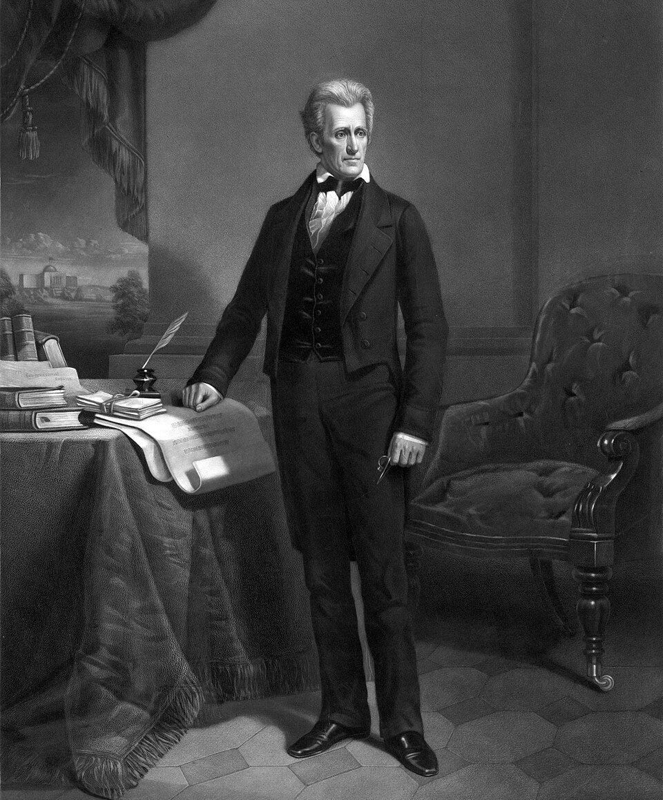
The path to its acquisition ran through Andrew Jackson's military campaigns of 1817 and 1818. Pursuing Seminole raiders and runaway enslaved people across the Florida border, Jackson swept through much of Spanish-controlled West and East Florida, capturing Pensacola in May 1818 and briefly removing the Spanish governor, José Masot. Jackson's actions were legally dubious as he had not been authorized to invade Spanish territory. However, Secretary of State John Quincy Adams defended them aggressively, turning Spanish outrage into leverage for a negotiated settlement.
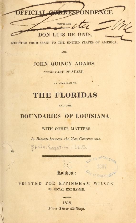
Adams conducted the resulting negotiations with Spanish Minister Luis de Onís with meticulous precision. The Adams-Onís Treaty, signed on February 22, 1819, secured the cession of both West and East Florida to the United States in exchange for American assumption of up to $5 million in claims by American citizens against Spain, and American renunciation of any claims to Texas west of the Sabine River.[43] Adams recorded the occasion in his diary with characteristic solemnity:
"What the consequences may be of the compact this day signed with Spain is known only to the all-wise and all beneficent Disposer of events."[44]
Spain delayed ratification for two years, partly due to the upheaval of the Spanish Revolution of 1820. Final ratification came in 1821, and on July 17, 1821, Andrew Jackson received formal transfer of the Floridas from the Spanish governor at Pensacola. It was a ceremony laden with irony, since it was Jackson's own military aggression that had made Spanish resistance futile.
After Jackson's brief tenure as provisional military governor, Congress organized the Territory of Florida on March 30, 1822, merging the former Spanish colonies of East and West Florida into a single administrative unit. The first civilian governor was William Pope Duval, who would serve from 1822 to 1834. The new territory operated with dual capitals, St. Augustine in the east and Pensacola in the west. This reflected its dual origins until Tallahassee was chosen as a central capital in 1824, with the first legislative session held there in a log building in 1826.
The Pensacola district thus became the westernmost portion of Florida Territory, and eventually the western Florida Panhandle of the modern state of Florida. Of all four pieces of old West Florida, this was the only one that ended up in a place actually called Florida.
The Four-Part Dispersal: A Summary
Old West Florida, in other words, did not become any single state. It was dispersed across four:
- The Florida Parishes of Louisiana (Mississippi River to Pearl River) — entered the Union with Louisiana in 1812.
- The Gulf Coast of Mississippi (Pearl River to Pascagoula area) — entered the Union with Mississippi in 1817.
- The Mobile district of Alabama (Pascagoula area to Perdido River) — entered the Union with Alabama in 1819.
- The Pensacola district of Florida (Perdido River eastward) — organized as part of Florida Territory in 1822.
Each piece carried with it the complicated legal and diplomatic legacy of a province that three empires had claimed, one tiny republic had briefly governed, and the United States had absorbed through a combination of proclamation, military force, and treaty. Yes, this happened over the course of twelve remarkable years.
The Louisiana Purchase Question
At the heart of everything in this story, sat a single question. Did the Louisiana Purchase of 1803 include West Florida? The answer shaped three decades of American foreign policy, and it was never fully settled until Spain conceded the point by treaty in 1819.
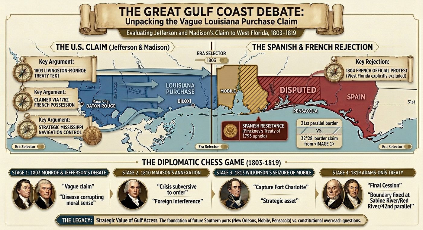
The American claim rested on a specific historical argument: that when France originally received Louisiana from Spain in 1762 (by the secret Treaty of Fontainebleau), the territory had included the Gulf Coast strip that would later be designated "West Florida." Therefore, when France sold Louisiana to the United States in 1803, the argument went, it should have included that strip, regardless of what Spain had done with the territory in the intervening decades.
Spain's counter-argument was simpler and, most historians agree, more legally sound: West Florida had been a distinct province under Spanish administration since 1783, separate from Louisiana, and had never been part of the 1800 retrocession to France in the first place. Part of what made the dispute so durable was that neither the 1800 nor the 1803 treaty included any accurate delimitation of Louisiana's boundaries. Nor had any prior Franco-Spanish transfer of the colony ever defined them. No one, in other words, knew with precision what the Louisiana Purchase actually covered, and that uncertainty was exactly the room in which American claims could grow.
Even France itself sided with Spain when the question was put to it directly: Paris told the Jefferson administration in 1804 that West Florida had not been part of the deal.[45]The Jefferson and Madison administrations nonetheless found it politically useful to maintain the contrary claim, and the treaty's ambiguity gave them just enough cover to do so. It was, in the judgment of most historians, a deliberate exploitation of legal vagueness in service of territorial expansion.
The American takeover of West Florida has therefore never been fully absolved of its legal problems. At first glance it might seem to have sprung from a worthy fight for self-government and independence from Spain. On closer inspection, however, this venture was rooted in the same ingrained American propensity for land-grabbing evident in other territorial acquisitions of the era. Madison had unilaterally proclaimed the annexation of foreign territory without a declaration of war, without Senate ratification of any treaty, and without even informing Congress until after the fact. The justification was that West Florida was already American territory as part of the Louisiana Purchase. This was at best arguable and at worst a legal fiction, as the foregoing analysis makes plain. But the action was popular enough domestically, and Spain was too weak to resist, so the annexation stood.
What Remained: A Landscape That Still Remembers
West Florida left its mark on the land in ways that are still readable today. The eight Florida Parishes of Louisiana, carrying the Florida name, are lived-in places where the memory of 1810 is still visible on the ground. Visitors to Baton Rouge walk streets that were briefly the capital of a forgotten country, and St. Francisville, once the seat of government of North America's shortest-lived republic, is still one of the most charming small towns in Louisiana. Local historical societies in the Felicianas keep the story of the convention movement and the rebellion alive, with reenactments of the September 1810 attack on Fort San Carlos still staged in Baton Rouge today.
Beyond the parishes themselves, the wider landscape of old West Florida carries its history quietly. Mobile grew into one of the antebellum South's most important ports, its waterfront built on the same Gulf trade that had made the territory worth fighting over. Pensacola, the old capital of Spanish West Florida, became a major U.S. naval installation and remains one today. And the white-sand beaches, longleaf pine forests, and barrier islands of the western Florida Panhandle are now simply "Florida" to the millions of tourists who visit each year, with little sign that the land was ever called anything else.
The Cast of Characters
The story of West Florida from 1810 to 1822 is populated by a remarkable set of individuals:
- James Madison (President 1809–1817): The architect of the annexation policy, Madison used legal argumentation and executive action to absorb West Florida while officially denying any support for the rebellion that triggered it. His October 27, 1810 proclamation is among the most consequential — and constitutionally controversial — executive actions of the early republic.[46]
- Fulwar Skipwith (1765–1839): A Virginia-born Revolutionary War veteran, diplomat, and former U.S. Consul-General in France, Skipwith was the first and only governor of the Republic of West Florida. The man who had helped negotiate the very Louisiana Purchase that was being used against his republic was inaugurated on November 29, 1810 — eleven days before the republic's fall — and served as its head of state for those final days alone. He spent the rest of his life farming in Baton Rouge, dying there in 1839.[47]
- Philemon Thomas (1763–1847): The military commander of the September 23 assault on Fort San Carlos, Thomas was a Kentucky-born Revolutionary War veteran who led the rebel forces that actually seized Baton Rouge. He later served as a U.S. Congressman from Louisiana.
- William C.C. Claiborne (1775–1817): Governor of Orleans Territory, Claiborne was the instrument of Madison's annexation policy. It fell to him to organize the former republic's territory into American administrative structures, which he did efficiently, if not without controversy.[48]
- David Holmes (1769–1832): Governor of Mississippi Territory, Holmes played a crucial role as Madison's eyes, ears, and agent in the region, reporting on the rebellion and helping coordinate the American response.
- John Rhea (1753–1832): President of the West Florida Convention, Rhea signed the declaration of independence on September 26, 1810. A Scots-Irish immigrant who had fought in the Revolution, he was one of the convention's most experienced political hands and its most prominent public face.
- Andrew Jackson (1767–1845): Jackson's military campaigns of 1817–1818 effectively forced Spain's hand on the question of Florida, and his appointment as provisional governor in 1821 brought the long struggle for West Florida to its conclusion. His role was characteristically aggressive, legally questionable, and ultimately decisive.[49]
- John Quincy Adams (1767–1848): As Secretary of State, Adams negotiated the Adams-Onís Treaty with meticulous skill, securing both Floridas while surrendering American claims to Texas. His diary entry on the day of signing captures his awareness of the moment's significance.[50]
- Don Luis de Onís (1762–1827): The Spanish Minister to the United States who negotiated the treaty bearing his name, Onís bargained hard but ultimately conceded Florida in exchange for the American abandonment of Texas claims — a trade that would have enormous long-term consequences.[51]
Conclusion: A Forgotten Chapter with Long Consequences
Between April 1810 and March 1822, West Florida passed through one of the most remarkable political transformations in North American history. In little more than a decade, the region moved from Spanish rule to an independent republic, through American annexation, and finally into the United States as part of the expanding Union. The borders of the Gulf Coast and with them the future of the American South, were permanently redrawn.
Today, the episode is largely forgotten. Its geography was complicated, its timeline overlapped with the War of 1812, and the American government long portrayed the annexation as the settlement of an existing legal claim rather than the acquisition of new territory. Yet the incorporation of West Florida was one of the defining territorial gains of the early republic. It secured American control of the Gulf Coast, strengthened the nation's strategic position, and opened lands that would become central to the rise of the Cotton Kingdom and the antebellum South.
The Republic of West Florida itself survived for only seventy-four days, but its legacy endured in unexpected ways. The lone white star of the Bonnie Blue Flag, first raised over a short-lived frontier republic, became one of the most enduring symbols of Southern independence half a century later. Few who gathered in Baton Rouge in 1810 could have imagined that their flag would outlive their republic by decades, or that their brief rebellion would echo through American history. West Florida reminds us that even the shortest-lived nations can leave lasting marks, not because they endure, but because the struggles fought over them reshape the political landscape long after the governments themselves have disappeared.
Places in this Story
The places this story moves through, in order — follow them on the interactive map →
- Baton Rouge, Louisiana April 20, 1810
Samuel Fulton, an American-born officer serving as adjutant general of the Spanish militia of West Florida, wrote directly to President Madison reporting on conditions in the province and reminding him of his long-standing wish to be useful to his own country, positioning a Spanish militia officer with the president's ear inside the conspiracy that was about to unfold.
- Egypt Plantation, near St. Francisville, Louisiana June 23, 1810
A large group of Feliciana residents gathered at this plantation, owned by Lewis Stirling, and called for the establishment of a convention to protect the district against foreign invasion and domestic disturbance, selecting four delegates to organize the movement further.
- St. Johns Plains, Louisiana July 25, 1810
Delegates from Feliciana, Baton Rouge, St. Helena, and Chifoncte convened here, electing John Rhea as chairman and drafting a resolution that outwardly pledged support to the Spanish governor while quietly stripping away his authority.
- Baton Rouge, Louisiana September 23, 1810
Colonel Philemon Thomas led an armed force against Fort San Carlos, the main Spanish garrison, capturing it after a brief fight, imprisoning Governor de Lassus, and raising the Bonnie Blue Flag over the ramparts.
- St. Francisville, Louisiana September 26, 1810
John Rhea, president of the West Florida convention, signed the Declaration of Independence here, formally establishing the Republic of West Florida with St. Francisville as its capital.
- Washington, D.C., United States October 27, 1810
President James Madison issued his proclamation announcing that the United States would take possession of West Florida, arguing that the territory had always been part of the Louisiana Purchase.
- Baton Rouge, Louisiana December 10, 1810
The last defenders of the Republic of West Florida marched out of Fort San Carlos and laid down their arms, bringing the seventy four day republic to its final end.
- New Orleans, Louisiana April 30, 1812
Congress admitted Orleans Territory to the Union as the state of Louisiana, bringing the former West Florida strip along with it as the newly formed Florida Parishes.
- Mobile, Alabama April 15, 1813
General Wilkinson's forces captured Mobile after the small Spanish garrison at Fort Charlotte surrendered without a fight, securing the finest natural harbor on the northern Gulf Coast for the United States.
- Pensacola, Florida May 1818
Andrew Jackson swept through Spanish controlled territory in pursuit of Seminole raiders, capturing Pensacola and briefly removing the Spanish governor, José Masot, in a legally dubious but consequential campaign.
- Washington, D.C., United States February 22, 1819
Secretary of State John Quincy Adams and Spanish Minister Luis de Onís signed the Adams-Onís Treaty here, securing the cession of both West and East Florida to the United States.
- Pensacola, Florida July 17, 1821
Andrew Jackson formally received the transfer of the Floridas from the Spanish governor, completing the long process of bringing the province under American control.
- St. Augustine, Florida March 30, 1822
Congress organized the Territory of Florida, merging the former Spanish colonies of East and West Florida into a single administrative unit with dual capitals at St. Augustine and Pensacola.
Important Dates
Samuel Fulton, an American commanding the Spanish militia in West Florida, wrote secretly to President Madison expressing his wish to be "usefull to my own Country," signaling that Madison had eyes inside the province months before the revolt.
American settlers gathered at Egypt Plantation in the Feliciana District and called for a formal convention, launching the organized political movement that would lead to rebellion.
The West Florida Convention met at St. Johns Plains, outwardly pledging to assist the Spanish governor while quietly stripping him of authority and preparing for armed revolt.
Colonel Philemon Thomas led rebel forces in a pre-dawn assault on Fort San Carlos at Baton Rouge, capturing the Spanish garrison and raising the Bonnie Blue Flag.
Convention president John Rhea signed the Declaration of Independence of the Republic of West Florida, bringing the seventy-four-day republic formally into existence.
President James Madison issued his proclamation annexing West Florida, asserting it had always been part of the Louisiana Purchase and directing Governor Claiborne to take possession.
The last defenders of the Republic of West Florida marched out of Fort San Carlos and laid down their arms, ending the republic after just seventy-four days.
General James Wilkinson accepted the surrender of the Spanish garrison at Mobile, bringing the most strategically valuable port on the northern Gulf Coast under American control.
Secretary of State John Quincy Adams and Spanish Minister Luis de Onís signed the Adams-Onís Treaty, by which Spain ceded both Floridas to the United States in exchange for American assumption of up to $5 million in citizen claims.
Congress officially organized the Territory of Florida, merging the former Spanish colonies of East and West Florida into a single American territory with William Pope Duval as its first civilian governor.
Frequently Asked Questions
What was the Republic of West Florida?
The Republic of West Florida was a short-lived independent nation declared on September 26, 1810, after American settlers seized the Spanish fort at Baton Rouge and raised the Bonnie Blue Flag. The republic lasted just seventy-four days before the United States annexed it under President James Madison's proclamation of October 27, 1810.
Why wasn't West Florida included in the Louisiana Purchase of 1803?
West Florida was excluded from the Louisiana Purchase because Spain had administered it as a separate province since 1783 and never included it in the 1800 retrocession of Louisiana to France — meaning France had no legal right to sell it. The United States disputed this for years, arguing the territory had historically been part of French Louisiana, but France itself sided with Spain on the question in 1804.
Where exactly was West Florida located?
West Florida was not the Florida peninsula but a narrow Gulf Coast strip running from the Mississippi River east to the Perdido River, covering territory that today includes the Florida Parishes of Louisiana, the Gulf Coast counties of Mississippi and Alabama, and the western Florida Panhandle. None of the territory lay within the borders of the modern state of Florida.
What is the Bonnie Blue Flag and where did it come from?
The Bonnie Blue Flag — a single white star on a deep blue field — was the flag of the Republic of West Florida, making it the first lone-star flag in American history, predating both the Republic of Texas and Confederate flags that later adopted the same imagery. It was sewn by Melissa Johnson, wife of Major Isaac Johnson of the West Florida Dragoons, and was raised over Fort San Carlos in Baton Rouge on September 23, 1810.
Did West Florida become part of the state of Florida?
Only a small portion of old West Florida — the Pensacola district east of the Perdido River — became part of the Florida Territory when it was organized on March 30, 1822. The rest was divided among three other states: the western strip became Louisiana's Florida Parishes in 1812, the Gulf Coast strip became part of Mississippi in 1817, and the Mobile district became part of Alabama in 1819.
Who was Fulwar Skipwith, the governor of the Republic of West Florida?
Fulwar Skipwith was a Virginia-born Revolutionary War veteran and diplomat who had served as U.S. Consul-General in France and helped negotiate the Louisiana Purchase — making him an ironic choice to govern a republic that existed partly because that same Purchase had failed to include West Florida. He was inaugurated as governor on November 29, 1810, just eleven days before American forces peacefully dissolved the republic.
How did Andrew Jackson and the Adams-Onís Treaty finally resolve the West Florida question?
Andrew Jackson's military campaigns of 1817 and 1818 — in which he captured Pensacola and effectively expelled Spanish authority from Florida — forced Spain to negotiate, leading Secretary of State John Quincy Adams to secure the Adams-Onís Treaty signed on February 22, 1819. Under the treaty, Spain ceded both West and East Florida to the United States in exchange for American assumption of up to $5 million in citizen claims against Spain and the abandonment of American claims to Texas.
Bibliography
Adams, John Quincy. Memoirs of John Quincy Adams, Comprising Portions of His Diary from 1795 to 1848. Edited by Charles Francis Adams. 12 vols. Philadelphia: J. B. Lippincott, 1874–1877.
Arthur, Stanley Clisby. Old Families of Louisiana. New Orleans: Harmanson, 1931.
Babcock, Kendrick C. Vol. 13 of The American Nation: A History. New York: Harper & Brothers, 1906.
Bemis, Samuel Flagg. John Quincy Adams and the Foundations of American Foreign Policy. New York: Alfred A. Knopf, 1949.
Brooks, Philip C. Diplomacy in the Borderlands: The Adams-Onís Treaty of 1819. Berkeley: University of California Press, 1939. Reprint, New York: Octagon Books, 1970.
Carter, Clarence E., ed. The Territorial Papers of the United States. Vol. 9, The Territory of Orleans, 1803–1812. Washington, D.C.: Government Printing Office, 1940.
Claiborne, William C. C. Claiborne to Thomas Jefferson, January 24, 1811. Founders Online, National Archives. https://founders.archives.gov/documents/Jefferson/03-03-02-0247.
Cox, Isaac Joslin. The West Florida Controversy, 1798–1818: A Study in American Diplomacy. Baltimore: Johns Hopkins Press, 1918.
Fulton, Samuel. Fulton to James Madison, April 20, 1810. In The Papers of James Madison: Presidential Series, vol. 2, edited by J. C. A. Stagg et al., 388–89. Charlottesville: University Press of Virginia, 1992. Founders Online. https://founders.archives.gov/documents/Madison/03-02-02-0389.
"Fulwar Skipwith." Dictionary of Louisiana Biography. Louisiana Historical Association. https://www.crt.state.la.us.
Graham, John. Graham to James Madison, August 3, 1810 (enclosing David Holmes to Robert Smith, July 31, 1810). In The Papers of James Madison: Presidential Series, vol. 2, edited by J. C. A. Stagg et al. Charlottesville: University Press of Virginia, 1992. Founders Online. https://founders.archives.gov/documents/Madison/03-02-02-0569.
Head, David. "February 22, 1819: The Adams-Onís Treaty Cedes Florida to the United States." Constituting America. https://constitutingamerica.org/february-22-1819-the-adams-onis-treaty-cedes-florida-to-the-united-states-guest-essayist-david-head/.
Higgs, Robert. "'Not Merely Perfidious but Ungrateful': The U.S. Takeover of West Florida." The Independent Review 9, no. 4 (Spring 2005): 503–15. https://www.independent.org/publications/article.asp?id=1478.
"James Madison: Key Events." Miller Center, University of Virginia. https://millercenter.org/president/james-madison/key-events.
"Louisiana Purchase Treaty," April 30, 1803. National Archives. https://www.archives.gov/exhibits/american_originals/louistxt.html.
Madison, James. Madison to Robert Smith, July 17, 1810. In The Papers of James Madison: Presidential Series, vol. 2, edited by J. C. A. Stagg et al., 530–32. Charlottesville: University Press of Virginia, 1992. Founders Online. https://founders.archives.gov/documents/Madison/03-02-02-0530.
Madison, James. "Proclamation 16 — Taking Possession of Part of Louisiana (Annexation of West Florida)," October 27, 1810. In A Compilation of the Messages and Papers of the Presidents, edited by James D. Richardson, 2:476–77. Washington, D.C.: Bureau of National Literature, 1897. American Presidency Project. https://www.presidency.ucsb.edu/documents/proclamation-16-taking-possession-part-louisiana-annexation-west-florida.
Republic of West Florida. Declaration of Independence, September 26, 1810. Transcribed in Louisiana State Courts Law Library, "West Florida Republic." https://lasc.libguides.com/c.php?g=683636&p=4847561.
"The Republic of West Florida — Forgotten Nation of the South." Explore Southern History. https://exploresouthernhistory.com/westflorida.html.
"The Republic of West Florida: Freedom Fight or Land Grab?" The Freeman: Ideas on Liberty. Foundation for Economic Education, June 2005. https://fee.org/articles/the-republic-of-west-florida-freedom-fight-or-land-grab/.
Rowland, Eron. "Philemon Thomas and the West Florida Revolution." Florida Historical Quarterly 39, no. 4 (April 1961): 378–86. https://penelope.uchicago.edu/Thayer/E/Gazetteer/Places/America/United_States/Florida/_Texts/FlaHQ/39/Philemon_Thomas_and_the_West_Florida_Revolution*.html.
Stagg, J. C. A. Borderlines in Borderlands: James Madison and the Spanish-American Frontier, 1776–1821. New Haven: Yale University Press, 2009.
Stagg, J. C. A., et al., eds. "Madison and the Collapse of the Spanish-American Empire: The West Florida Crisis of 1810." Editorial note. In The Papers of James Madison: Presidential Series, vol. 2, 311–38. Charlottesville: University Press of Virginia, 1992. Founders Online. https://founders.archives.gov/documents/Madison/03-02-02-0388.
"The Story of the West Florida Rebellion." Part 1. Penelope/UChicago. https://penelope.uchicago.edu/Thayer/E/Gazetteer/Places/America/United_States/Louisiana/_Texts/ARTWFR/1*.html.
"Treaty of Amity, Settlement, and Limits Between the United States of America and His Catholic Majesty (Adams-Onís Treaty)," February 22, 1819. Yale Avalon Project. https://avalon.law.yale.edu/19th_century/sp1819.asp.
"Treaty of Paris, 1763," February 10, 1763. Yale Avalon Project. https://avalon.law.yale.edu/18th_century/paris763.asp.
"Treaty of San Ildefonso," October 1, 1800. Yale Avalon Project. https://avalon.law.yale.edu/19th_century/ildefens.asp.
"Treaty of San Lorenzo (Pinckney's Treaty)," October 27, 1795. Yale Avalon Project. https://avalon.law.yale.edu/18th_century/sp1795.asp.
"Twilight of the Spanish, 1780s–1821." Florida Humanities. https://floridahumanities.org/blog/twilight-of-the-spanish-1780s-1821/.
Wasserman, Adam. "The 1810 West Florida Annexation Scheme." Libcom.org, June 28, 2009. https://libcom.org/history/1810-west-florida-annexation-scheme-0.
West Feliciana Historical Society and Museum. "West Florida Republic." https://www.westfelicianamuseum.org/westflorida.
"West Florida, 1803–1819." Florida Center for Instructional Technology (FCIT), University of South Florida. https://fcit.usf.edu/florida/maps/pages/2400/f2438/f2438.htm.
"West Florida Controversy." Encyclopaedia Britannica. https://www.britannica.com/event/West-Florida-Controversy.
"West Florida Revolt." 64 Parishes, Louisiana Endowment for the Humanities. https://64parishes.org/entry/west-florida-revolt.
Citations
- "Treaty of Paris, 1763," February 10, 1763, Yale Avalon Project. ↑
- "West Florida Controversy," Encyclopaedia Britannica. ↑
- "The Story of the West Florida Rebellion," Part 1, Penelope/UChicago. The 1767 boundary extension fixed West Florida's northern line at 32°28', at the mouth of the Yazoo River. ↑
- "Treaty of San Lorenzo (Pinckney's Treaty)," October 27, 1795, Yale Avalon Project. ↑
- "Treaty of San Ildefonso," October 1, 1800. The retrocession explicitly excluded West Florida, which remained under separate Spanish provincial administration. For the treaty text, see Yale Avalon Project. ↑
- "Louisiana Purchase Treaty," April 30, 1803, National Archives. The cession language — "the same extent that it now has in the hands of Spain, and that it had when France possessed it" — appears in Article I. ↑
- Adam Wasserman, "The 1810 West Florida Annexation Scheme," Libcom.org, June 28, 2009. ↑
- "James Madison: Key Events," Miller Center, University of Virginia. ↑
- Kendrick C. Babcock, quoted in Wasserman, "The 1810 West Florida Annexation Scheme." The original formulation appears in Babcock's contribution to The American Nation: A History, vol. 13 (New York: Harper & Brothers, 1906). ↑
- "James Madison: Key Events," Miller Center. ↑
- J. C. A. Stagg et al., eds., "Madison and the Collapse of the Spanish-American Empire: The West Florida Crisis of 1810," editorial note, in The Papers of James Madison: Presidential Series, vol. 2 (Charlottesville: University Press of Virginia, 1992), 311–38. Available at Founders Online, National Archives. ↑
- Ibid., 311–13. ↑
- Samuel Fulton to James Madison, April 20, 1810, in The Papers of James Madison: Presidential Series, vol. 2, ed. J. C. A. Stagg et al. (Charlottesville: University Press of Virginia, 1992), 388–89. Available at Founders Online, National Archives. ↑
- Ibid. ↑
- Ibid., editorial annotation. ↑
- James Madison to Robert Smith, July 17, 1810, in The Papers of James Madison: Presidential Series, vol. 2, ed. J. C. A. Stagg et al. (Charlottesville: University Press of Virginia, 1992), 530–32. Available at Founders Online, National Archives. Editorial annotation cites enclosed letter of David Holmes to Robert Smith, June 20, 1810, reporting that Spanish authority in West Florida had collapsed to the point that residents had formed an improvised "neighbourhood police" whose operations were judged both "inefficient" and "unjust." ↑
- Robert Higgs, "'Not Merely Perfidious but Ungrateful': The U.S. Takeover of West Florida," The Independent Review 9, no. 4 (Spring 2005): 503–15, citing Isaac Joslin Cox, The West Florida Controversy, 1798–1818: A Study in American Diplomacy (Baltimore: Johns Hopkins Press, 1918). ↑
- Stagg et al., "Madison and the Collapse of the Spanish-American Empire," 319. ↑
- Robert Smith to William Wykoff, Jr., June 20, 1810, in Clarence E. Carter, ed., The Territorial Papers of the United States, vol. 9, The Territory of Orleans, 1803–1812 (Washington, D.C.: Government Printing Office, 1940), 883–84. Quoted in Stagg et al., "Madison and the Collapse of the Spanish-American Empire," 319–20. ↑
- Madison to Robert Smith, July 17, 1810. ↑
- "The Republic of West Florida — Forgotten Nation of the South," Explore Southern History. ↑
- Higgs, "'Not Merely Perfidious but Ungrateful,'" citing Cox, The West Florida Controversy. ↑
- "West Florida Revolt," 64 Parishes, Louisiana Endowment for the Humanities. ↑
- "The Story of the West Florida Rebellion," Part 1, Penelope/UChicago. ↑
- "The Story of the West Florida Rebellion," Part 1, Penelope/UChicago. ↑
- West Feliciana Historical Society and Museum, "West Florida Republic." ↑
- John Graham to James Madison, August 3, 1810 (enclosing David Holmes to Robert Smith, July 31, 1810), in The Papers of James Madison: Presidential Series, vol. 2, ed. J. C. A. Stagg et al. (Charlottesville: University Press of Virginia, 1992). Available at Founders Online, National Archives. ↑
- West Feliciana Historical Society and Museum, "West Florida Republic." ↑
- Eron Rowland, "Philemon Thomas and the West Florida Revolution," Florida Historical Quarterly 39, no. 4 (April 1961): 378–86. Available via Penelope/UChicago. ↑
- "West Florida Controversy," Encyclopaedia Britannica. ↑
- "The Story of the West Florida Rebellion," Part 1, Penelope/UChicago. ↑
- "The Republic of West Florida — Forgotten Nation of the South," Explore Southern History. ↑
- Rowland, "Philemon Thomas and the West Florida Revolution," 378–86. ↑
- Republic of West Florida, Declaration of Independence, September 26, 1810, transcribed in Louisiana State Courts Law Library, "West Florida Republic." ↑
- Ibid. ↑
- Fulwar Skipwith, biographical entry, Dictionary of Louisiana Biography, Louisiana Historical Association, cited in "Fulwar Skipwith," Louisiana State Museum. The Jefferson family connection through Henry Skipwith is noted in Stanley Clisby Arthur, Old Families of Louisiana (New Orleans: Harmanson, 1931). ↑
- Marching song of the Republic of West Florida, quoted in "The Republic of West Florida: Freedom Fight or Land Grab?" The Freeman: Ideas on Liberty, Foundation for Economic Education, June 2005. The verse's exact original provenance has not been definitively established in the scholarly literature. ↑
- James Madison, "Proclamation 16 — Taking Possession of Part of Louisiana (Annexation of West Florida)," October 27, 1810, in A Compilation of the Messages and Papers of the Presidents, ed. James D. Richardson (Washington, D.C.: Bureau of National Literature, 1897), 2:476–77. Full text also available at the American Presidency Project. ↑
- Ibid. ↑
- "James Madison: Key Events," Miller Center. ↑
- "The Republic of West Florida: Freedom Fight or Land Grab?" The Freeman, Foundation for Economic Education. ↑
- "West Florida, 1803–1819," Florida Center for Instructional Technology (FCIT), University of South Florida. ↑
- "Treaty of Amity, Settlement, and Limits Between the United States of America and His Catholic Majesty (Adams-Onís Treaty)," February 22, 1819, Yale Avalon Project. See also Philip C. Brooks, Diplomacy in the Borderlands: The Adams-Onís Treaty of 1819 (Berkeley: University of California Press, 1939; reprint, New York: Octagon Books, 1970). ↑
- John Quincy Adams, diary entry, February 22, 1819, in Memoirs of John Quincy Adams, Comprising Portions of His Diary from 1795 to 1848, ed. Charles Francis Adams, 12 vols. (Philadelphia: J. B. Lippincott, 1874–1877), 4:274–75. Quoted in David Head, "February 22, 1819: The Adams-Onís Treaty Cedes Florida to the United States," Constituting America. ↑
- "James Madison: Key Events," Miller Center. See also J. C. A. Stagg, Borderlines in Borderlands: James Madison and the Spanish-American Frontier, 1776–1821 (New Haven: Yale University Press, 2009), 50–54. ↑
- Madison, "Proclamation 16." ↑
- "Fulwar Skipwith," Dictionary of Louisiana Biography. ↑
- William C. C. Claiborne to Thomas Jefferson, January 24, 1811, Founders Online, National Archives. ↑
- "Twilight of the Spanish, 1780s–1821," Florida Humanities. ↑
- Adams, diary entry, February 22, 1819. See also Samuel Flagg Bemis, John Quincy Adams and the Foundations of American Foreign Policy (New York: Alfred A. Knopf, 1949), 307–32. ↑
- "Treaty of Amity, Settlement, and Limits (Adams-Onís Treaty)," Yale Avalon Project. See also Brooks, Diplomacy in the Borderlands. ↑